 |
 |
 |
 |
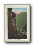
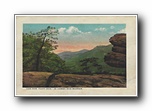
| The Devils Head, near Chimney Rock hmcxf001a01-09 |
Parking Place at Base of Chimney Rock, Western North Carolina hmcxf001a01-10 |
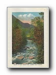
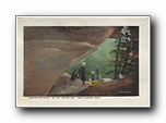
Source of Rocky Broad River, Chimney Rock Country hmcxf001a01-11 |
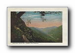
View from "Appian Way," Chimney Rock Mountain hmcxf001a01-12 |
 |
 |
 |
 |
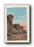
| View from "Pulpit Rock," on Chimney Rock Mountain hmcxf001a01-13 |
"Inspiration Point" on the "Appian Way," near Chimney Rock hmcxf001a01-14 |
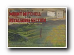
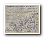
(folder) Souvenir Folder of Mount Mitchell and Royal Gorge Section Western North Carolina (18 cards / 0 BR) hnmxf0001a01-01 |
(back of folder) US Highway 70 at Point Lookout hnmxf0001a01-02 |
 |
 |
 |
 |
| (description inside folder) hnmxf0001a01-03 |
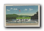
Swimming Pool, Club House and Beautiful Lake Tomahawk, Black Mountain hnmxf0001a01-04 |
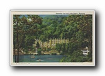
Assembly Inn and Lake Susan, Montreat hnmxf0001a01-05 |
Bird's-eye View of Lake Susan, Assembly Inn at left, Montreat hnmxf0001a01-06 |
 |
 |
 |
 |
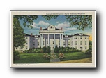
| Pritchell Hall, Ridgecrest Baptist Assembly, Ridgecrest hnmxf0001a01-07 |
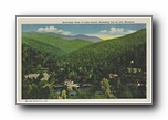
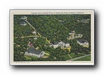
Airplane View showing portion of Ridgecrest Baptist Assembly, Ridgecrest hnmxf0001a01-08 |
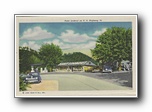
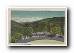
Point Lookout on State Highway 70 hnmxf0001a01-09 |
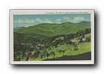
Mt. Mitchell, alt 6684 feet, Highest Peak east of the Rockies hnmxf0001a01-10 |
 |
 |
 |
 |
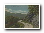
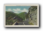
| Winding Highway Cut thru Solid Rock, in the Heart of the Mountains hnmxf0001a01-11 |
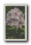
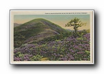
Purple Rhododendron in Bloom, in the Heart of the Mountains hnmxf0001a01-12 |
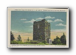
Observation Tower, Mt. Mitchell, NC, alt 6684 ft., "Highest Peak East of the Rocky Mountains", Showing Grave of Dr. Mitchell and Government Weather Station hnmxf0001a01-13 |
Looking from Mouth of one Tunnel into another Tunnel on Blue Ridge Parkway hnmxf0001a01-14 |
 |
 |
 |
 |
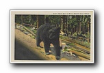
| Native Black Bear in Mount Mitchell Game Refuge hnmxf0001a01-15 |
Scene from US Highway No. 70, showing Southern Railroad Tunnel hnmxf0001a01-16 |
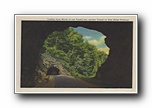
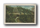
View of Point Lookout on US Highway 70, Royal Gorge is seen in Background hnmxf0001a01-17 |
Purple Rhododendron in Bloom near Blue Ridge Parkway hnmxf0001a01-18 |