 |
 |
 |
 |
| On the side of "Pinnacle" on the way to Mt Mitchell, altitude 6711 feet, Western North Carolina x19-spc0b759a01-f |
x19-spc0b759a01-r x19-spc0b759a01-r |
Automobiles Climbing the Wonderful Scenic Road to Mt Mitchell, Altitude 6,711 feet "In the Land of the Sky" x19-spc0b760a01-f |
x19-spc0b760a01-r x19-spc0b760a01-r |
 |
 |
 |
 |
| Panorama of Magnificent Mountains on Auto Road to Mt. Mitchell, altitude 6711 feet x19-spc0b761a01-f |
x19-spc0b761a01-r x19-spc0b761a01-r |
Along the Scenic Road to Mt Mitchell, Mt Mitchell to right, altitude 6711 feet x19-spc0b762a01-f |
x19-spc0b762a01-r x19-spc0b762a01-r |
 |
 |
 |
 |
| Mt. Pisgah Among the Clouds as seen from Camp Laurel, "In The Land of the Sky" x19-spc0b764a01-f |
x19-spc0b764a01-r x19-spc0b764a01-r |
At the foot of the Craggies, "In the Land of the Sky" x19-spc0b765a01-f |
x19-spc0b765a01-r x19-spc0b765a01-r |
 |
 |
 |
 |
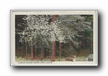
| Dogwood Blossoms, Western North Carolina x19-spc0b766a01-f |
x19-spc0b766a01-r x19-spc0b766a01-r |
Mountain Laurel, "In the Land of the Sky" Western North Carolina x19-spc0b767a01-r |
x19-spc0b767a01-r x19-spc0b767a01-r |
 |
 |
 |
 |
| Mt. Pisgah from Auto Parkway, Grove Park, Asheville NC x19-spc0b768a01-f |
x19-spc0b768a01-r x19-spc0b768a01-r |
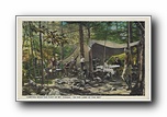
Camping near the foot of Mt Pisgah "In the Land of the Sky" x19-spc0b775a01-f |
x19-spc0b775a01-r x19-spc0b775a01-r |
 |
 |
 |
 |
| Hickory Nut Gap from the Appian Way, Chimney Rock, Western North Carolina x19-spc0b778a01-f |
x19-spc0b778a01-r x19-spc0b778a01-r |
On the Asheville - Black Mountain Highway, Western North Carolina x19-spc0b784a01-f |
x19-spc0b784a01-r x19-spc0b784a01-r |